Community
Education
Culture
Lifestyle
Food
Business
Health
Environment
Tech
Sports
Search
Community
Education
Culture
Lifestyle
Food
Business
Health
Environment
Tech
Sports
Search
Search
Tag - kstan
Developer ignores DBKL stop work order
Tan Kai Swee
March 26, 2012
205th Police Day
Tan Kai Swee
March 26, 2012
Putrajaya: Up up and away
Tan Kai Swee
March 23, 2012
Orang Asli women cry out “Tiada tanah tiada kita”
Tan Kai Swee
March 21, 2012
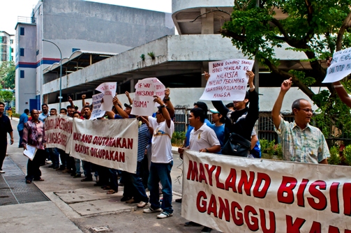
Nube to Maybank: Stop union busting
Tan Kai Swee
March 4, 2012
RM50k windfall for Sri Subramaniar Temple, Sunway
Tan Kai Swee
February 19, 2012
Community
Education
Culture
Lifestyle
Food
Business
Health
Environment
Tech
Sports